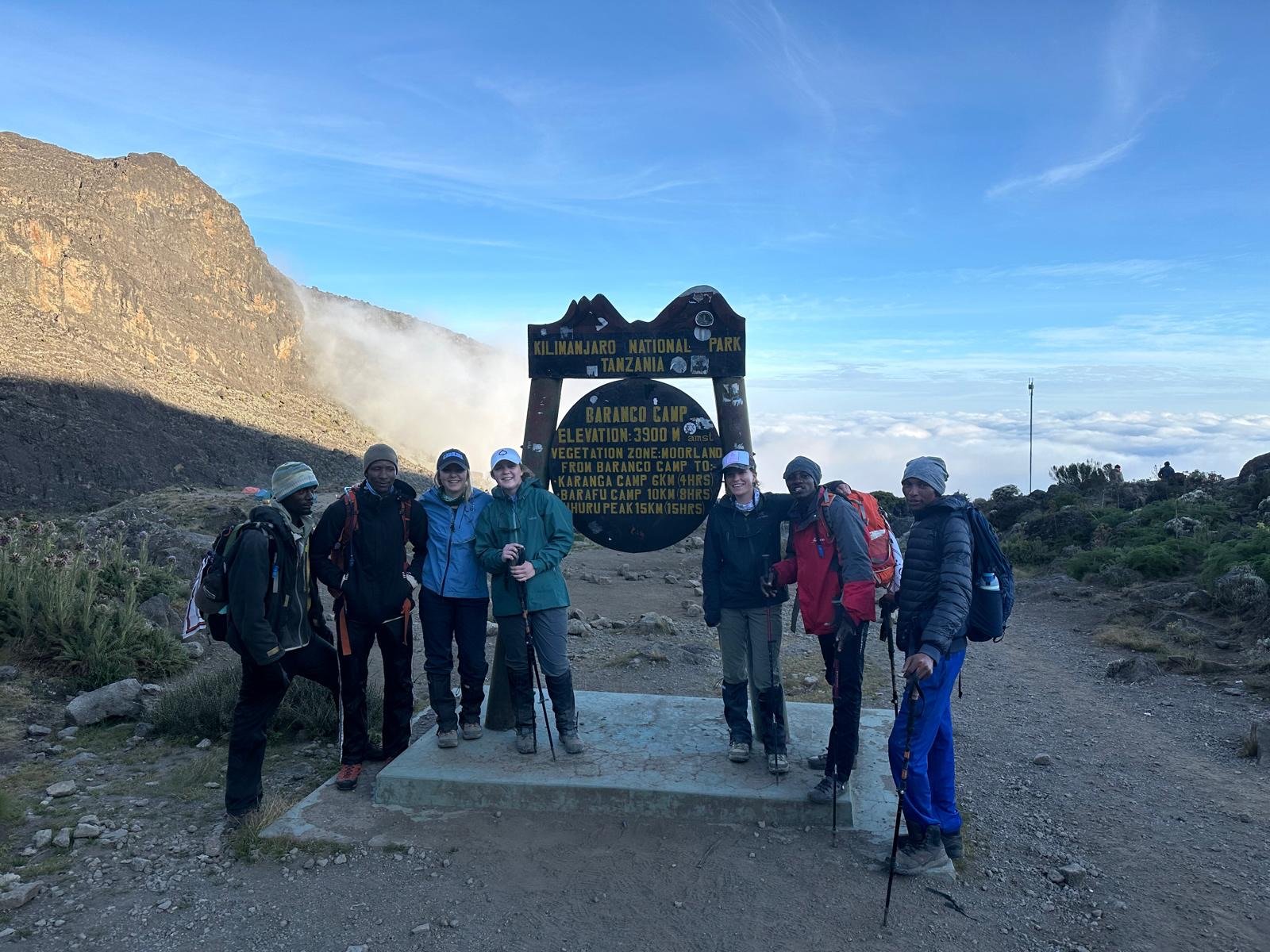
Day 5: Climb to Barranco Camp


MOUNTAIN ROUTE OVERVIEW
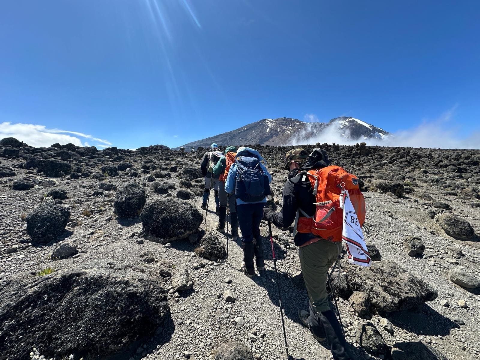
Today, the trail runs through a black lava desert past millions of boulders. From the Shira Plateau, the group will go up a ridge, past the trail to the peak of Kibo, to Lava Tower (known by locals as Shark’s Tooth). During their lunch break, they can take in the snowline above the Lava Tower. After lunch, they’ll descend to the Barranco Camp at an altitude of 13,000 feet. The black lava desert fades into heather and moorland. From Barranco Camp, they’ll see the Barranco Wall, the Western Breach of Kibo, and the South Glacier. This is where their hike ends – and they rest and have dinner. Because their bodies are exposed to such a high elevation at lunch, this is one of the most important days for acclimatization and will prepare our climbers’ bodies for summit day.
MOUNTAIN ROUTE STATS
Starting elevation 12,500 feet | Ascend to 15,000 feet at Lava Tower
Ending elevation 12,900 feet in Baranco Valley
Net elevation gain 400 feet
Distance hiked 6 miles
Average hiking time 7 to 9 hours
Today was all about acclimatization—it was a long one but a great one. The first part of our day was spent hiking on the ridge from the Shira Plateau towards Lava Tower. It was super windy, but very cool to look at the wispy clouds moving through the mountain ahead of us. After about 5 hours of hiking, our team set up an amazing lunch for us at the base of the trail where it splits to either hike up to Lava Tower (16,000ft), or the lower route to camp. Because the girls were doing so great, we made our way up to Lava Tower! This is the highest point we will reach before the campsite on Summit Night, so it’s super beneficial to help prepare our bodies for that. We took some pictures when we reached Lava Tower ~1.5 hours later—we’re all so happy the girls felt great at that altitude—awesome news!
Making our way down to Baranco Camp was about 2 hours, which is where the tiredness from the length of the day kicked in a little bit. It was incredibly scenic. The monstrosity of this mountain became more apparent as we looked around at the incredible views around us. The sun shined on the upper face of the mountain as glacial rivers streamed below us. We could also see Mount Meru peeking out from the cloud line, which put into perspective how high we are now that we’re above that peak. As we went further toward the camp, we entered a completely different landscape. We were surrounded by these crazy cool- looking trees called Senecio and waterfalls as we looked down on the camp below us, sitting at the foot of the clouds.
When we got to camp and had our evening tea and popcorn, the sun set, turning the sky a soft pink. Not even 1 minute after the sun was finally set, the clouds began to roll over camp, creating a cool misty environment. Baranco Camp sits right at the base of the Great Baranco Wall that we’ll conquer tomorrow… stay tuned!
Pamoja pamoja.